Luxembourg Maps
Explore Confidently with Luxembourgish Maps
If you're passionate about outdoor activities in Luxembourg, the quality of maps you use can make all the difference in your exploration experience. OpenRunner is delighted to provide you easy access to Luxembourgish maps, including the Topo map and Hybrid map, allowing you to plan precise and enriching adventures.
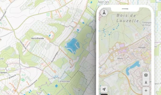
The Luxembourgish Topo map on OpenRunner is your essential companion for hiking, cycling, orienteering, and all your outdoor escapades. This detailed map offers a complete view of the terrain, trails, rivers, roads, and other significant landscape features in Luxembourg. Whether you're an experienced hiker or a novice explorer, the Topo map simplifies route planning, ensuring a successful exploration at every step.
For an even more immersive experience, opt for the Hybrid map on OpenRunner. This unique map combines a satellite view with road information and trails, providing a comprehensive perspective of your surroundings. Whether you want to explore hidden trails, scenic routes, or simply have an accurate overview of the region, the Hybrid map is a versatile tool suitable for all your outdoor activities.
To maximize your experience with Luxembourgish maps on OpenRunner, choose the Explorer pack. By opting for this pack, you not only gain access to the Topo and Hybrid maps but also benefit from advanced features that enrich your exploration experience.
Plan personalized routes, record your activities, track your performance, and synchronize your data with GPS devices. The Explorer pack is the ideal investment for outdoor adventure enthusiasts in Luxembourg, offering a comprehensive solution to make each outing more enjoyable, safer, and more memorable.
In conclusion, Luxembourgish maps on OpenRunner, including the Topo and Hybrid maps, are your essential allies for successful exploration of the Grand Duchy. Opt for the Explorer pack to unlock all advanced features and turn every outing into a well-planned adventure. Embark now with OpenRunner and discover Luxembourg like never before!
The Luxembourg map backgrounds included in the EXPLORER offer